View Mount Tamalpais in a larger map
I started by driving to a little parking lot just on the north side of the Golden Gate Bridge, at the end of Alexander Avenue. I'm completely unfamiliar with the area, so followed the route recently described by Bill Bushnell, which appeared to be comprehensive. It would take me all the way around the mountain, offering lots of different experiences and a reasonable distance, for me.
 |
| San Francisco Bay, from Sausalito. Angel Island on the left, Alcatraz in the middle, San Francisco toward the right |
I got started a little after 10 AM, on a clear and cool day. Alexander Avenue crosses under the highway and then becomes the main drag through Sausalito, after changing names several times. It was here I found that I had not properly calibrated by altimeter, since it was reading 70 feet below sea level on Bridgeway Road. I suspect it was reading 100 feet too low.
 |
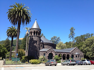
| A seminary in San Anselmo, on the "wrong" Bolinas Ave. |
A little farther north I got to Bolinas Avenue, a little earlier than expected, and turned to ride up the mountain. But this was the wrong Bolinas, it turns out, so I returned to San Anselmo Avenue and continued north. A couple of miles and one town further north, I got the right Bolinas and headed west.
Bolinas starts the real climbing, reaching 1000 feet after a climb of about 3 miles, with an average gradient of about 5.5%. It climbs along a steep ridge with lots of houses. The houses have little decks on which to park cars, then stairs down to the houses below. Bolinas climbs past a county club, tops a ridge, then descends through thick woods toward Alpine Lake, about 400 feet lower.
 |
| Alpine Lake |
 |
| The dam at Alpine Lake |
The climb away from the lake is perhaps the prettiest part of this ride, climbing up switchbacks on a heavily wooded ridge. It reminded me of the upper part of Black Road. While it seemed steep at the time, it appears to average a grade of only 5.9%. The most difficult KM of the day was in this section, with an average grade of 8%.
 |
| A switchback on Bolinas, climbing up from Alpine Lake |
 |
| Looking west from Ridgecrest. Bolinas is in the lower-right. |
 |
| The east peak of Tamalpais, with Mount Diablo in the background. Toward the right, Angel Island and San Francisco |
I took the steep Pan Toll Road down to the Panoramic Highway, then dropped through a series of residential roads into Mill Valley. This must be the more popular route up Mount Tamalpais, because I passed dozens of riders coming the other way. At the end of Miller Road I got back on the bike trail, and reversed my steps back to the parking area.
 |
| Mist blowing past the Golden Gate Bridge |
I returned to the car and began the long trip home, now firmly in rush hour traffic. It was well worth it.
 |
| Elevation profile. This appears to be about 100 feet low. |
No comments:
Post a Comment